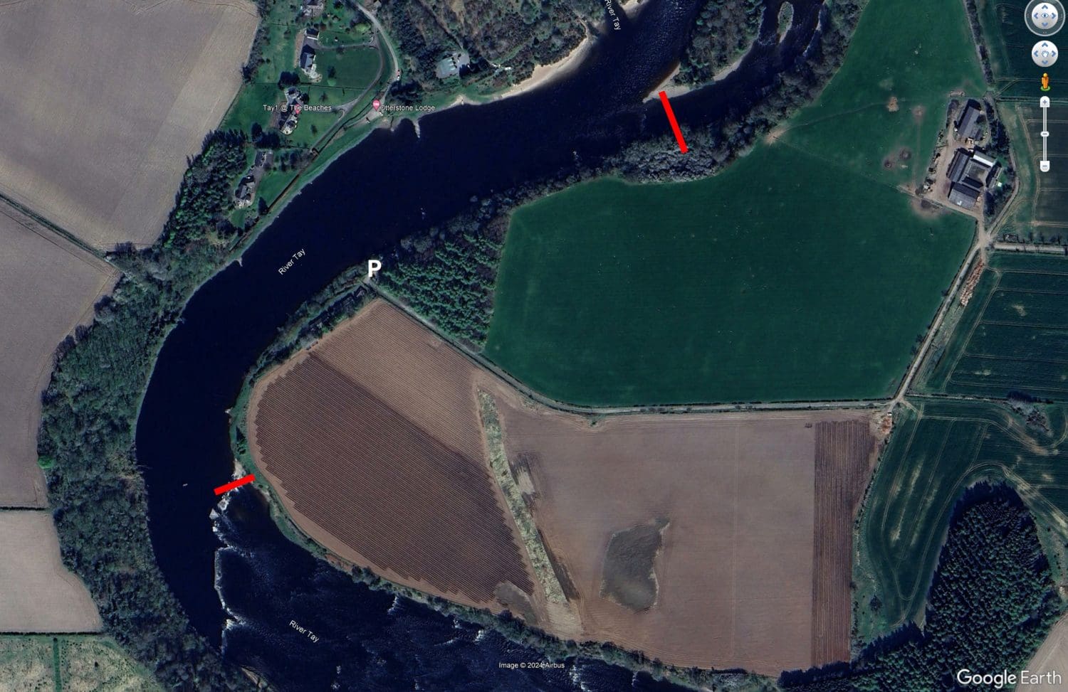
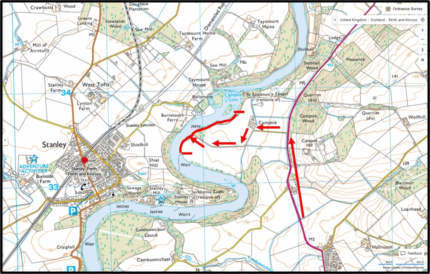
River Tay at Caputh, from upstream march of Upper Delvine almost to the bridge at Caputh, 2 miles left bank, 1.5 miles right bank.
Two bank rods per day Monday to Saturday from July until the end of the season on alternating weeks. First week will start 5 July, next week 19 July etc. There are two additional boat rods, with ghillie, on applicable Fridays ie 9 July, 23 July etc
CONTACT INFO: Simon Furniss Mob - 07736379104
Email - sjpfurniss@btinternet.com
COVID-19 rules will be updated in line with Scot Gov latest rules/guidelines: The boat will take only one angler (plus the ghillie). The optimum way of managing this is the two balloted boat rods take turns in using the boat ie In the morning, one angler takes the boat and the other fishes from the bank. After lunch anglers swap places.
2021 Availability
5th July - 15th Oct - alternating weeks beginning 5 July, 19 July, 2 Aug, 16 Aug, 30 Aug, 13 Sep, 27 Sep, 11 Oct
Mon
Two bank rods, online
Tue
Two bank rods, both balloted
Wed
Two bank rods, online
Thur
Two bank rods, both balloted
Fri
2 rods online + 1 balloted boat for 2
Sat
Two bank rods, both balloted
Safety & General Advice
The beat commences 600 metres below Caputh bridge, and continues downstream to the march with Upper Devine. It is set in secluded countryside, the right bank is tree lined and the left bank is open farmland.
There are 11 named pools, Sparrowmuir pool which is 530 yards long, Sparrowmuir stream, Burnbane pool, Sandy Bay, Sycamore tree, Burnbane, Corner pool, Big stone, Twin trees, Salt hole, Darroch pool.
There is some classic streamy fly water for fly fishing from the bank or wading the tail of Sparrowmuir, Sparrowmuir stream, the Corner Pool, Tail of Burnbane Pool, the Salt hole and Darroch pool wading only.
Click here for Delvine & Burnbane Beat Map
Access
Directions(SATNav:PH1 4JB)
Traveling northwards from Perth to Caputh on the B9099, after crossing the Caputh bridge, in about 350yds (as you enter the village) on your right you will see a post box immediately before a white house. Turn right at the post box and travel about half a mile down the gravel track. The fishing hut is on the right-hand side and as yet we do not have access to it, but there is a car park in which to park your vehicle to fish the upper beat. The combination for the hut car park padlock is 2112 and this must be locked when the last angler leaves. If you have a suitable vehicle, there is also vehicle access as far as the Corner Pool by coming back onto the track, turning right, and following the track until you come to a large wooden shed. Turn right after the shed and go through the gate. This gate must always remain closed. Follow the track and bear right towards the gravel beach. Cars can be parked on the gravel beach only as indicated on the beat Map (not on the adjacent grass bank). DO NOT DRIVE ON THE EMBANKMENT WALL UNDER ANY CIRCUMSTANCES. To fish the bottom half of the beat down to the Salt Hole, access is by foot only, walking down the side of the growing crops. Please adhere to the track and be mindful of the crops. All gates must be left closed.